Zoom map to this postcode:
Boundary Lines courtesy of Ordnance Survey OpenData © Crown copyright 2019, Map © OpenStreetMap contributors
The Boundary Commissions will start work on the new Westminster seat boundaries in December 2020 and they should be completed by 2023. If you don't want to wait that long for the official version, Electoral Calculus has created its own example set to give an idea of what to expect.
An Electoral Calculus algorithm has created an example set of new seat boundaries. These boundaries are completely unofficial and separate from the work of the Boundary Commissions. But they have followed the same rules that the Boundary Commissions will use, so they might not be too far away in terms of political impact, although the specific map of any individual area may be very different.
The national electorate quota for each non-island seat is 72,886 voters. The number of seats allocated to each region and island seat, is given in the first table. This shows the currently over-represented areas at the top, such as Wales and the North East, and the under-represented areas at the bottom, such as the South and East of England.
| Area | Current Average Electorate | 2019 Seats | New Average Electorate | Number New Seats | Change |
|---|---|---|---|---|---|
| Western Isles | 21,649 | 1 | 21,649 | 1 | 0 |
| Orkney and Shetland | 34,816 | 1 | 34,816 | 1 | 0 |
| Isle of Anglesey | 51,932 | 1 | 51,932 | 1 | 0 |
| Wales (*) | 57,110 | 39 | 71,848 | 31 | −8 |
| North East | 66,353 | 29 | 74,009 | 26 | −3 |
| West Midlands | 70,464 | 59 | 72,936 | 57 | −2 |
| Scotland (*) | 71,041 | 57 | 72,310 | 56 | −1 |
| North West | 71,870 | 75 | 72,841 | 74 | −1 |
| Yorks/Humber | 72,121 | 54 | 73,481 | 53 | −1 |
| Northern Ireland | 72,531 | 18 | 72,531 | 18 | 0 |
| London | 74,279 | 73 | 73,275 | 74 | +1 |
| East Midlands | 75,628 | 46 | 72,477 | 48 | +2 |
| South West | 76,255 | 55 | 72,311 | 58 | +3 |
| Anglia | 77,178 | 58 | 73,382 | 61 | +3 |
| South East (*) | 78,212 | 83 | 72,939 | 89 | +6 |
| Isle of Wight | 111,440 | 1 | 55,720 | 2 | +1 |
| Total | 72,664 | 650 | 72,664 | 650 | 0 |
(*) Indicates exclusion of island seats, which are shown separately.
We can also imply the result of the 2019 General Election, as if these example boundaries had been used, while assuming that every voter would have voted the same way as they did with the old boundaries.
| Party | 2019 Votes | Actual (old) Seats | Example (new) Seats | Change |
|---|---|---|---|---|
| CON | 44.7% | 365 | 380 | +15 |
| LAB | 33.0% | 203 | 194 | −9 |
| LIB | 11.8% | 11 | 6 | −5 |
| Brexit | 2.1% | 0 | 0 | 0 |
| Green | 2.8% | 1 | 0 | −1 |
| SNP | 4.0% | 48 | 49 | +1 |
| PlaidC | 0.5% | 4 | 3 | −1 |
| Other | 1.1% | 0 | 0 | 0 |
| DUP | 8 | 10 | +2 | |
| SF | 7 | 5 | −2 | |
| SDLP | 2 | 3 | +1 | |
| Alliance | 1 | 0 | −1 | |
| Total | 100.0% | 650 | 650 | 0 |
The Conservatives gain around 15 seats and Labour lose about 10 seats. Changes like this are expected because Wales and the North East of England are over-represented and lose seats, and areas such as the South and East of England are under-represented and gain seats. The predicted loss of five Liberal Democrat seats may not be an accurate prediction, since the Lib Dems often cope with changing boundaries with effective local campaigning.
Disregarding the Lib Dem seats for a moment, there is a predicted net swing of about 10 seats from Labour to Conservative as a result of the example boundary changes. This is equivalent to a swing of about 1pc in the popular vote from Labour to Conservative, which is a relatively modest move. In the year 2020 so far, there was an initial pro-Conservative swing of 6pc, and then a counter-swing back to Labour of more than 10pc. So a 1pc swing is small compared with those political trends.
This article contains details of the algorithm used to generate the example new boundaries, as well as creating artificial examples of what unfair (or Gerrymandered) boundaries would look like. These unfair boundaries can be used to create a test to check whether the final official new boundaries are indeed relatively fair or not.
Electoral Calculus has produced a simple algorithm to generate an example set of new constituency boundaries. This algorithm aims to satisfy the main legislative constraints on the new boundaries:
The algorithm optimises over the set of all possible boundaries (within a specified region). The algorithm requires each region to have the correct number of seats, and each seat must be made up of entire wards (as at 2020) which connect together. It then tries to find the best outcome so that each seat has an electorate as close as possible to the national quota, as well as trying to keep each seat within a single district council if possible, and compact in shape (rather than thin or scraggly).
Zoom map to this postcode:
Boundary Lines courtesy of Ordnance Survey OpenData © Crown copyright 2019, Map © OpenStreetMap contributors
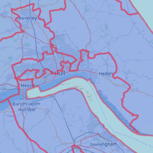
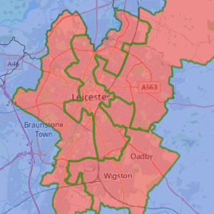
The map above shows the example new seats. Seats are given a background colour to indicate the implied seat winner at the December 2019 general election.
Algorithms are useful, but not perfect. Some seats are slightly crinkly and others cross district/county boundaries, or natural boundaries such as rivers. And a few seats are more than 5pc away from the national electorate quota. But as a general idea, the example set of new boundaries gives an impression of what the real new boundaries might look like.
Some people wonder whether the new boundary process is inherently unfair. The word "gerrymander" is often invoked in this context, which relates to the drawing of strangely shaped constituencies which unfairly benefit one party at the expense of another.
The initiation of a boundary review is not, by itself, an act of gerrymandering. It is an established feature of political life that these happen from time to time, to keep things fair by having seats of approximately equal size. Before the Great Reform Act of 1832, some seats had shrunk to nearly nothing over the centuries, while modern cities were under-represented. That wasn't fair, and boundary reviews help keep things fair. However, the next review will likely benefit the Conservative party who have been much keener on initiating the process than Labour. The Conservatives find that their own self-interest and a principle of good governance happily coincide.
The question of fairness or unfairness becomes one of whether the new seats have been drawn to show bias in favour of one party or another. The Boundary Commissions are supposed to be impartial and are not meant to draw the maps to favour any particular party. But how can we check that their seats are fair? We could start by comparing the electoral impact of the official boundaries with that of our example set. But we need a sense of scale to decide if those two sets are "close" or "further apart".
One way to do that is to create illustrative examples of what a strongly unfair and biased drawing of the electoral boundaries would look like. Let's do this twice – once with a pro-Conservative bias and once with a pro-Labour bias. We tweaked the Electoral Calculus new boundary algorithm to temporarily lose its ethical compass and create the most biased set of new seats that it could.

| 
|
The overall results are shown in this table.
| Method | CON | LAB | LIB | Brexit | Green | SNP | Plaid | DUP | SF | SDLP | Total |
|---|---|---|---|---|---|---|---|---|---|---|---|
| Pro-CON bias | 451 | 127 | 4 | 0 | 0 | 49 | 1 | 13 | 3 | 2 | 650 |
| Pro-LAB bias | 320 | 253 | 9 | 0 | 0 | 48 | 2 | 9 | 8 | 1 | 650 |
| Average of biased sets | 385.5 | 190 | 6.5 | 0 | 0 | 48.5 | 1.5 | 11 | 5.5 | 1.5 | 650 |
| Unbiased set | 380 | 194 | 6 | 0 | 0 | 49 | 3 | 10 | 5 | 3 | 650 |
There are two important facts that the table shows. Firstly, a biased approach can make a difference to the outcome, even if every voter's vote is unchanged. A biased set of boundaries can swing around 60 seats either towards or away from one of the two big parties. That's equivalent to a swing in the popular vote of about 5pc, which is quite substantial. In countries where politicians can control the precise constituency boundaries, it's very tempting for them to optimise that choice.
It also gives us a sense of scale. If sixty seats is a large difference, then our original unbiased example set of new boundaries is quite close to the average of two biased approaches, since the difference between them is only about five seats. This fact provides a useful test of whether the final recommendations from the Boundary Commissions are fair or not. If the implied result of the last general election for the official new seats is close to that of our unbiased example, then the Boundary Commissions have genuinely been unbiased. But if their implied result is further from the centre and closer to either of our extremely biased outcomes, then there would be cause for concern.
We hope that the Boundary Commissions will be as fair as always, but it's nice that we have a way of checking that and showing publicly that the process is transparent.
The Boundary Commissions are expected to make final recommendations by 2023.