National Seat Map

Browsable seat map
This browsable map shows all the seats with their boundaries and seat markers coloured for the winning party, overlaid on Open Street Map.
Clicking on a seat shows the predicted winner, using current opinion polls, and also gives the option of getting full details about the seat.
Prediction Map

Dynamic map
This unique map can show both true geography and also an equal-area for a more representative view. It also shows the last election, our/your predicted results, and the changes on a seat-by-seat basis.
Data Map

Data Map
Uniquely detailed Data Map of the whole country showing twelve political and social measures including party vote in 2019, 2017 and 2015, left/right and international/national attitudes, and EU referendum result.
All available at four geographic levels of detail: current seats, proposed new seats, wards, and individual neighbourhood localities.
Local Maps

Individual seat map
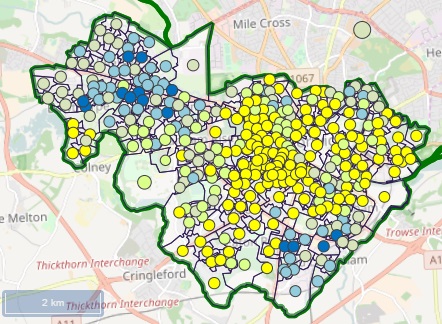
See each seat in glorious detail with Open Street Map overlaid with seat and ward boundaries, plus ward markers showing the party winner.
Get started with the Seat Explorer or just enter your postcode:
Timeline

Timeline from 1955
An interactive timeline map of all general elections since 1955, showing how the country voted area-by-area, with political commentary and overview of swings and trends.
Travel through British electoral history either going forwards and backwards.
Administrative boundaries

Large Area map
A popular classic map, this static Area Map shows the twelve official areas of the UK, along with the traditional county boundaries.
Note this map is 380kB in size.
Administrative boundaries
Area Definitions Map
This map is a smaller-sized version of the Large Area map above. It includes the full definition of the twelve areas in terms of both historic counties and district, borough and unitary councils.
Psephological boundaries
Regional Definitions Map
This map gives the definitions of the twenty Electoral Calculus regions, which are designed for long-term political analysis, and are distinct from any administrative boundaries.
New Boundaries
New Boundaries 2018
An interactive map of the now abandoned new seat boundary proposals for 2018. The map shows all the new seats, overlaid on Open Street Map.
The map is browsable and has links to details of each seat.